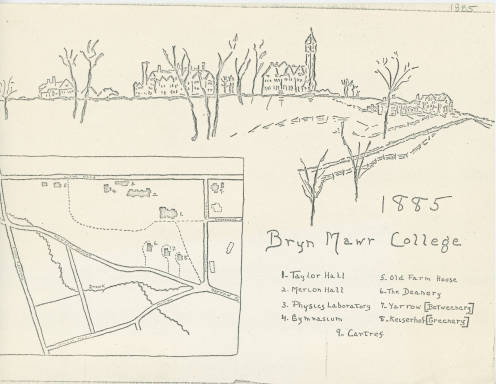
Campus Map circa 1885 found on Triptych
For my final project, I am examining history tour apps and proposing one for Bryn Mawr. This semester I have been fascinated with discussions we have had about expanding the narratives of spaces, layered histories, and alternate history exhibitions. I see a thoughtfully designed history app as a potential way to represent contrasting and often conflicting histories about spaces.
I think a tour app hypothetically can interact with a wider variety of campus visitors than traditional tours. I am aiming to design something that a casual visitor, a dog walking local, students, and others with varying degrees of interest in Bryn Mawr’s history can all use.
I originally thought about modeling my tour app on SPARK’s Movement’s “Women on the Map” project which uses Google Maps to alert users “when they are near places where women made history.”
After meeting with Monica, and as a result looking at few other projects such as the “Histories of the National Mall,” the StoryCorp app, and Harvard’s campus tour app, my proposed app has morphed. Now I want to include elements from all of the aforementioned projects to create something that will suit Bryn Mawr, allow for a plurality of stories and experiences to be told while being more accessible to users. I plan to examine and evaluate the projects Monica suggested along with the Philadelphia Maps and Walks app to see what works and what doesn’t.